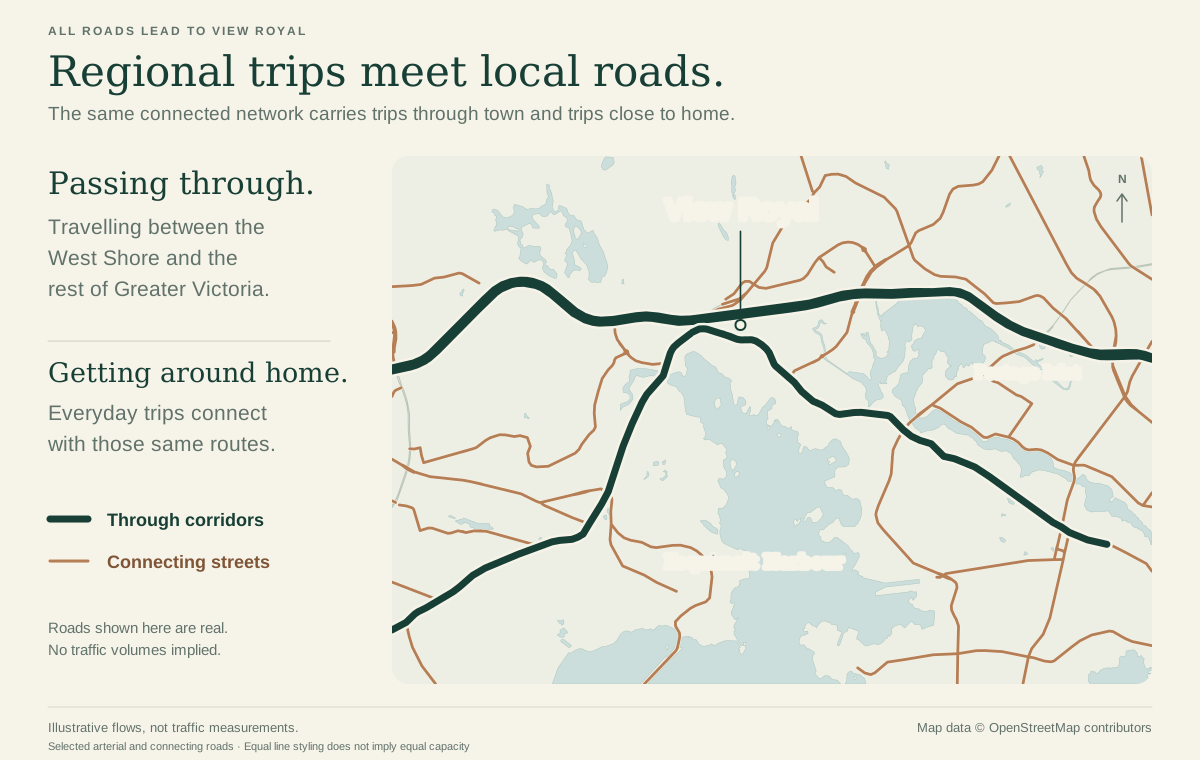
All Roads Lead to View Royal
View Royal connects Victoria’s urban core with the West Shore. That makes transportation here a local issue and a regional one.
I’m starting a series of posts exploring how we move around and through View Royal, whether we’re driving, taking the bus, cycling or walking.
I tend to look at transportation as a connected network. When we change one part of it, what happens elsewhere? Does it help people get where they’re going, or just move the problem to the next intersection? That’s the approach I’d bring to council.
I’ll share some ideas here, with more detail on my website for anyone interested. Keep an eye out for my first post on Saturday.
Read the original Facebook postAll Roads Lead to View Royal | Part 1: Between McKenzie and Helmcken
I’m starting this series to share some of my ideas for getting around View Royal, whether you’re driving, taking the bus, cycling or walking.
First up is the stretch of Highway 1 between McKenzie and Helmcken, where new bus lanes are being built.
Could these also work as exit-only lanes for drivers taking the next exit? I see this stretch as a major bottleneck during the morning and evening commute.
My proposal is to ask the Province to review that possibility in both directions, as shown on the map:
- Toward Langford: Drivers could use the lane between McKenzie and Helmcken if they’re exiting at Helmcken.
- Toward Victoria: Drivers could use the lane between Helmcken and McKenzie if they’re taking the McKenzie/Admirals exit.
The idea is to separate exiting traffic from through traffic earlier. For example, someone joining the highway from McKenzie and leaving at Helmcken could stay in that lane rather than having to merge into highway traffic, only to move back out again shortly afterwards.
Highway 1 is the Province’s responsibility. If elected, I’d bring forward a motion asking staff to write to the Province requesting a review with BC Transit, including safety and the impact on bus travel times. I’d also invite neighbouring municipalities to join the request.
I would love to hear your thoughts on the idea, and if you think it could help smooth out some of this traffic bottleneck.
Read the original Facebook postAll Roads Lead to View Royal: Part 2
For Part 2, I’m focusing on the junction where the E&N Trail and Galloping Goose connect near the Island Highway and Burnside Road West.
This part of View Royal deserves some attention. Large dirt mounds, blackberry bushes and a concrete support pillar block sightlines, making it difficult to see people approaching the junction from different directions.
With more e-bikes and e-scooters using our trails, we need to pay attention to how people walking and riding at different speeds can safely share these spaces.
I want View Royal to work with the CRD to review this junction and identify practical improvements. That could include cutting back vegetation, assessing whether the dirt mounds can be safely reshaped, and looking at changes to the trail layout around the bridge support.
Slowing down and yielding are important, but people also need to be able to see who they’re yielding to. Our trails deserve the same attention to safety as our roads.
Do you use this junction? I’d like to hear your experience.
Read the original Facebook postAll Roads Lead to View Royal - Part 3: Clearer lane markings at Six Mile Road
On the Island Highway, after Atkins Road and approaching Six Mile Road near the Shell station, I’ve noticed drivers moving into the right-hand lane shortly after the bus stop, before the dashed markings begin.
I find the transition between the bus lane and the right-turn lane unclear. The dashed lines allowing drivers to enter the right-turn lane begin only a short distance before the Six Mile Road intersection. This can be confusing, particularly for drivers familiar with the Douglas Street bus lanes in Victoria, where motorists are permitted to enter the priority lane when making a right turn within the current block.
If elected, I would bring forward a motion asking the Town of View Royal to work with BC Transit to review the signs and lane markings at this location.
The image shows one option I’d like assessed: beginning the dashed white line just after the bus stop and moving the “Bus Lane Ends” sign to match, giving right-turning drivers an earlier, clearly marked entry point.
The first step would be to confirm where drivers are currently permitted and expected to move over, and why the existing transition was placed where it is. The review could then determine whether an earlier endpoint is appropriate, or whether clearer right-turn access markings would address the issue while keeping the bus lane in place.
Any change would need to account for buses leaving the stop, turning traffic during busy periods, and people cycling.
My goal is a clearer transition for road users while maintaining bus priority.
Image is an illustrative concept
Read the original Facebook post